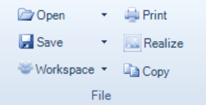
The topography offers several ways of saving, opening and copying 3D data.

A topographic 3D view can be printed to any type of standard printer.
Realize
Realizes the topographic image currently shown.
The 3D surface or 2D profile image will be saved as a 2D image. This image can be viewed in most graphics programs.
Copy
Copies the 3D surface or 2D profile image currently shown to the clipboard as a realized 2D image.
This image can be pasted into most graphics’ programs.
The chart can then be inserted in e.g. a Microsoft Word document.