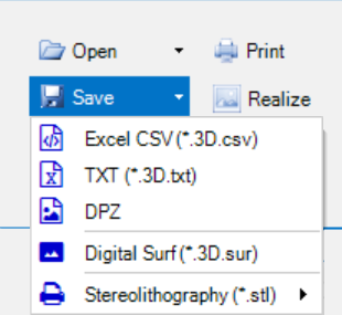
3D images can be saved in a variety of file formats.

Topographic 3D images can be saved as comma-separated-values, plain ASCII text, or proprietary binary format DPZ.
Alternatively, the 3D image can be saved in a Digital Surf compatible format, for further analysis in the Digital Surf Mountains Map software,
TXT format
Optionally the surface data can be exported as a flat CSV or TXT file.
The file format is proprietary but can easily be parsed by 3rd party software.
The format is <indexX>, <indexY>,<ValueX>, <valueY>, <valueZ>, <red>, <green>, <blue>, <alpha>
//------------------------------------------------------------
// DeltaPix InSight
// Chart has 160 x 106 datapoints.
// Unit XY is 0,011mm / point
// Unit Z is µm
// Saved: 20-10-2019 09:41:30
//------------------------------------------------------------
0000; 0000; 00000,000; 00000,000; 00003,063; 145; 125; 156; 255
0001; 0000; 00000,011; 00000,000; 00003,063; 144; 129; 163; 255
0002; 0000; 00000,021; 00000,000; 00003,063; 125; 126; 150; 255
0003; 0000; 00000,032; 00000,000; 00003,063; 153; 134; 153; 255
0004; 0000; 00000,042; 00000,000; 00002,784; 136; 131; 145; 255
0005; 0000; 00000,053; 00000,000; 00002,784; 136; 123; 148; 255
0006; 0000; 00000,063; 00000,000; 00002,506; 138; 119; 152; 255
0007; 0000; 00000,074; 00000,000; 00002,506; 138; 123; 155; 255
0008; 0000; 00000,084; 00000,000; 00002,227; 144; 131; 163; 255
0009; 0000; 00000,095; 00000,000; 00002,227; 143; 137; 163; 255
0010; 0000; 00000,105; 00000,000; 00001,949; 150; 133; 158; 255
0011; 0000; 00000,116; 00000,000; 00001,671; 141; 137; 156; 255
Stereolithography
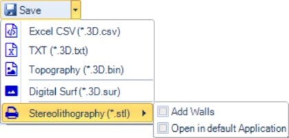
To export the topographic 3D surface to a 3D printer, the stereolithographic STL file format can be used.

The STL file can have side walls added, and optionally automatically opened in the default STL application after creation.
Workspace
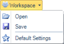
Different topographic workspaces can be saved, this makes the switch from one topographic analysis type to another easy.

Save your topography workspace for a specific analysis, and simply load it next time the same task needs to be done.